

Wildfires in the Amazon and in Australia: Data, tools, apps.
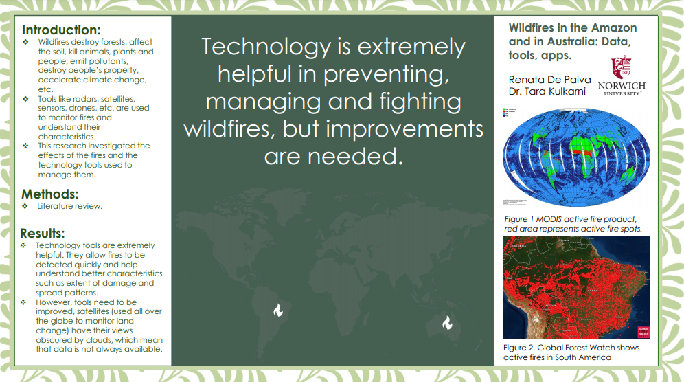
2019 was a record-breaking year for forest wildfires. In addition to the raging California wildfires in the United States and many parts of the world, the two that made the most headlines were the fires in the Amazon and the bushfires in Australia. These fires are monitored by technologies such as satellites, radars, drones, and sensors. However, upgrades are needed. There needs to be a better understanding of the characteristics of fires and an improvement of the tools used to monitor them. Satellites, for example, have their view obstructed by clouds, imaging sensors like the Moderate Resolution Imaging Spectroradiometer (MODIS) by NASA, do not have a resolution good enough to detect smaller changes on the forest landscape. Issues like these make it harder to prevent and manage fires, resulting in a significant loss of forestry. The resulting loss contributes to climate change, weakens the soil, and threatens biodiversity as well as indigenous and non-indigenous communities. The use of technology to fight wildfires has been proven helpful and cost-effective. Combining different technologies, like radars and satellites, can help guarantee that more accurate data are delivered to government officials. Also, artificial intelligence and machine learning could offer ways to improve prediction capabilities. This research reviews current literature to investigate the characteristics of fires, as well as the strengths and weaknesses of the tools used to manage them. A variety of technology tools were also assessed in how they are used to track and manage wildfires.