
Creating a Landslide Susceptibility Map for Caledonia County, Vermont through a Weighted Overlay in GIS
Eastern Vermont is highly susceptible to mass earth movements
due to landslide-inducing factors throughout the region. The
advent of LiDAR data and a detailed landslide dataset allow for
an unprecedented analysis of past and future landslide hazards.
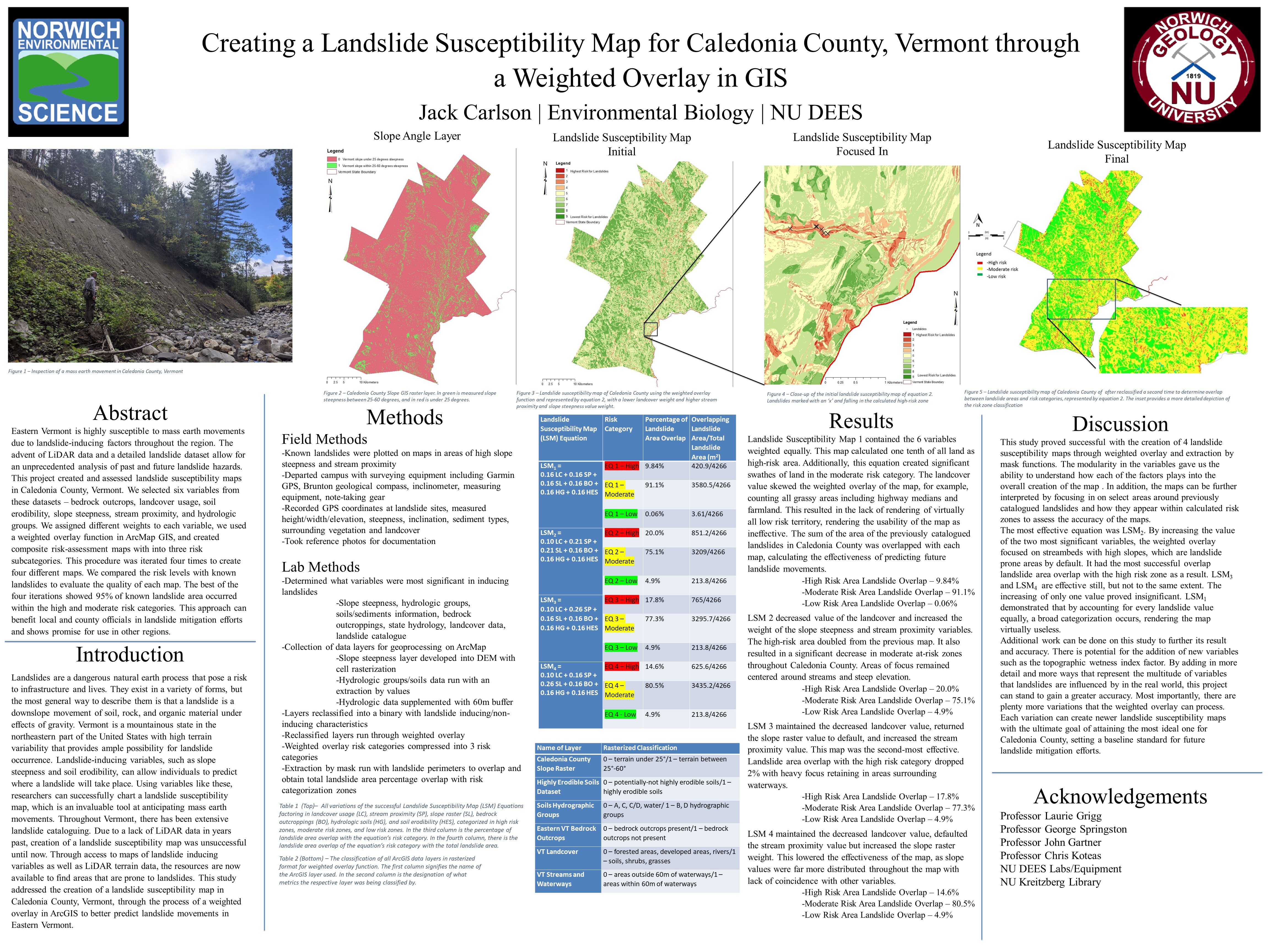
This project created and assessed landslide susceptibility maps
in Caledonia County, Vermont. We selected six variables from
these datasets – bedrock outcrops, landcover usage, soil
erodibility, slope steepness, stream proximity, and hydrologic
groups. We assigned different weights to each variable, we used
a weighted overlay function in ArcMap GIS, and created
composite risk-assessment maps with into three risk
subcategories. This procedure was iterated four times to create
four different maps. We compared the risk levels with known
landslides to evaluate the quality of each map. The best of the
four iterations showed 95% of known landslide area occurred
within the high and moderate risk categories. This approach can
benefit local and county officials in landslide mitigation efforts
and shows promise for use in other regions