 CLOSE SIDEBAR
Benthic Habitat Suitability of the Endangered Hawaiian Monk Seal (Neomonachus schauinslandi)
Hunter Nueku
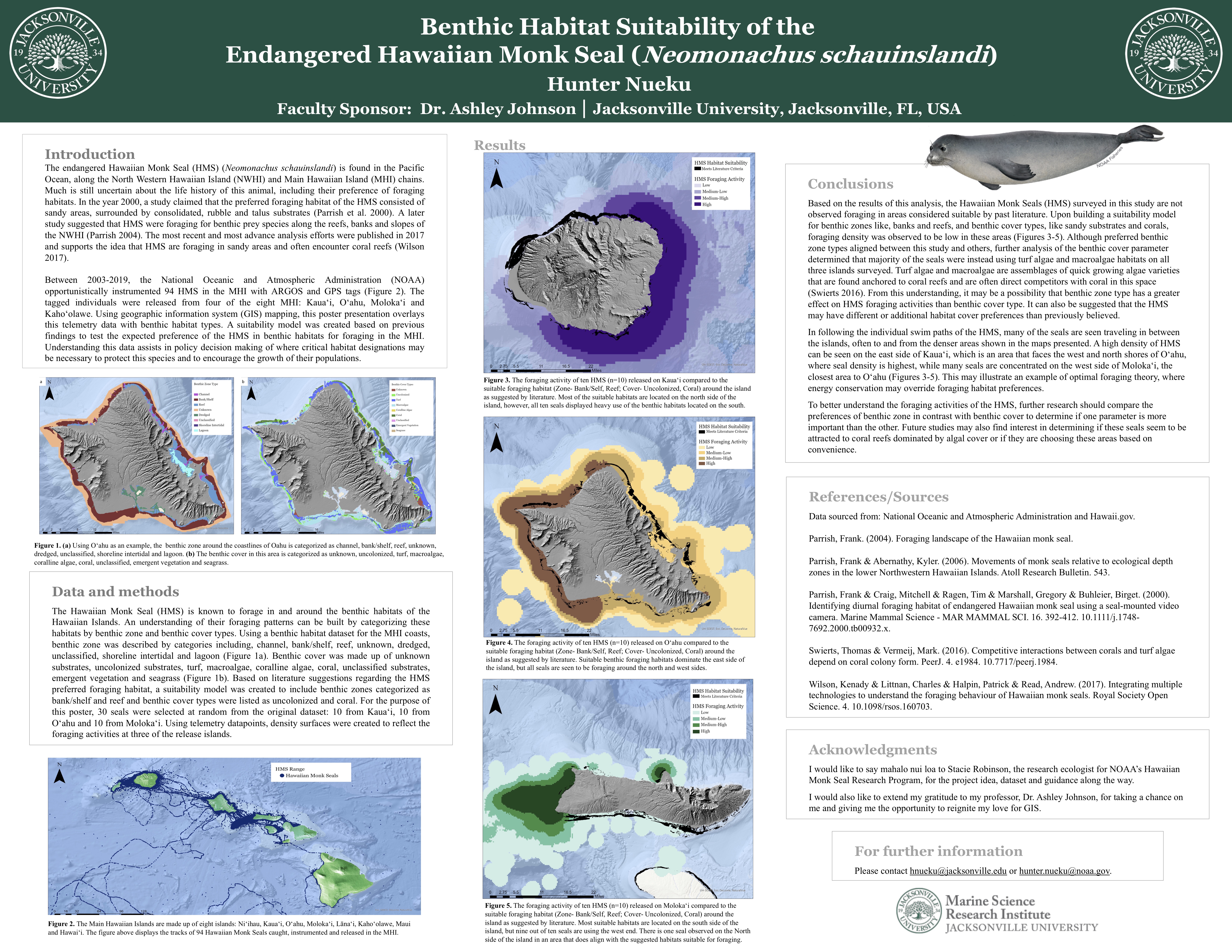
Much is still uncertain about the life history of the endangered Hawaiian Monk Seal (HMS) (Neomonachus schauinslandi). One thing researchers struggle to understand is their preference in foraging habitats in Hawaiian waters. Between the years of 2003-2019, 94 HMS were opportunistically instrumented in the Main Hawaiian Islands (MHI) with the intent to identify the home ranges of the species and their distance traveled during foraging. This research uses geographic information system (GIS) mapping to overlay benthic habitat types over telemetry data. A suitability model based on what previous findings believe to be favorable foraging parameters was then used to determine the preference of the HMS in benthic habitats for foraging in the MHI. Understanding this data assists in policy decision making of where critical habitat designations may be necessary to protect this species and encourage the growth of their populations.
Powered by Acadiate
© 2011-2024, Acadiate Inc. or its affiliates · Privacy