 CLOSE SIDEBAR
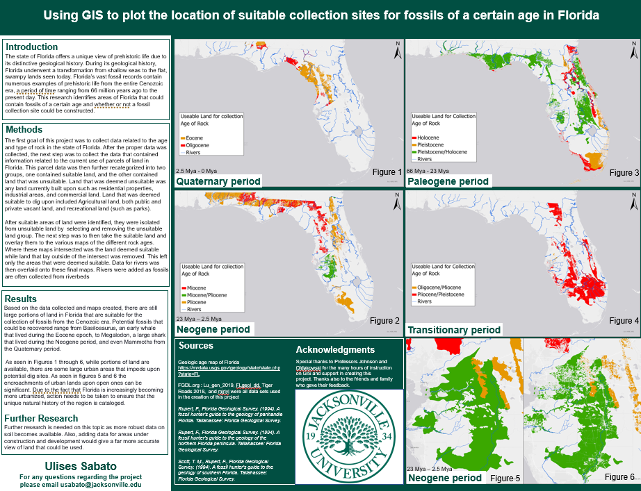
Using GIS to plot the location of suitable collection sites for fossils of a certain age in Florida by Ulises Sabato 1
The state of Florida offers a unique view of prehistoric life due to its distinctive geological history. During its geological history, Florida underwent a transformation from shallow seas to the flat, swampy lands seen today. Florida’s vast fossil records contain numerous examples of prehistoric life from the entire Cenozoic era. This research attempts to identify areas of Florida that contain fossils of a certain age. By compiling the proper data, it is possible to use geographic information systems (GIS) mapping technology to plot where fossils of a specific age are most likely found. This is accomplished by overlaying the data of the different layers of rock with areas of land that are already occupied or otherwise deemed unacceptable. These areas that are deemed unacceptable are then removed. This leaves the map only showing areas where potential fossil dig sites could be constructed. This research would show those interested in collecting fossils the most suitable areas to search for them.