 CLOSE SIDEBAR
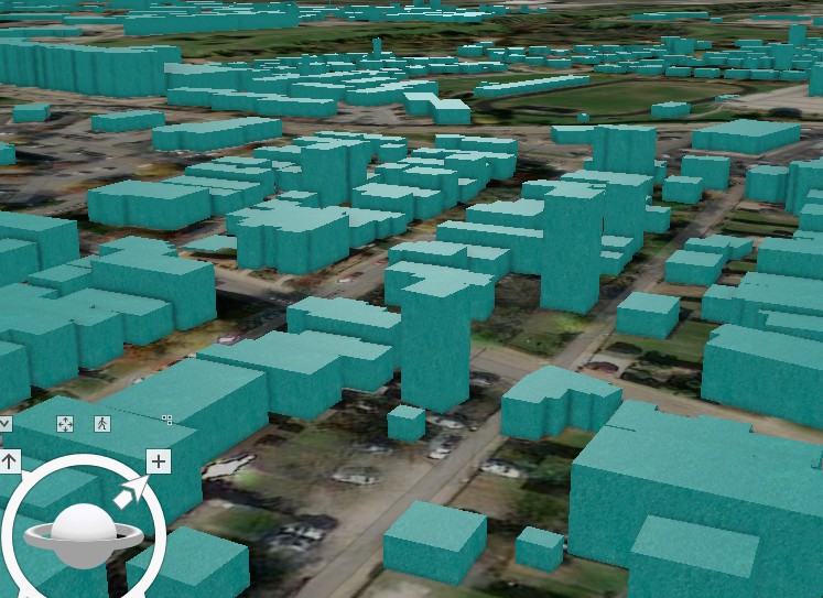
Often old and outdated, frequently, urban electric grids in America are at odds with residential and commercial usage requirements. Recent weather events, such as the 2021 winter storm in Texas, have exposed serious vulnerabilities in the resilience of the electric infrastructure to support unprecedented surges in electricity demand. The growing threat of such events with climate change and the migration of populations into urban centers requires a reassessment of energy consumption patterns in most US cities. While both private providers and state regulatory bodies have detailed information on energy consumption patterns, there is a need to develop computational models to predict consumption patterns during extreme weather events, including winter storms and heatwaves. Further, electric grids are typically built to optimize the protection of the grids themselves, rather than to minimize the human impact of electric grid failures, which tend to disproportionately impact vulnerable and hard-to-reach populations. This research uses a 3D model of the buildings in Marion County, Indiana to create a gradient of energy usage with the granularity of a single building and propose a plan for grid distribution optimized for human-centric usage and need. In this poster, we will demonstrate the 3D building geometry for Marion County on which we will base this optimization problem. We plan to utilize open-source data from the Department of Energy, county building footprint GIS and building specification data, and ESRI 3D modeling to produce the geometric input of a county-wide building energy model automated by a computational workflow developed using JSON and the Ruby programming language.
Powered by Acadiate
© 2011-2026, Acadiate Inc. or its affiliates · Privacy